Two coordinates. 43.6713°N, -1.442°E puts you off a pine forest in the French Landes, staring at La Gravière. 68.268°N, 13.581°E puts you above the Arctic Circle, looking at Unstad from a road cut into gneiss. Every print-shop listicle we have read frames "Hossegor vs Lofoten" as a mood question — warm versus cold, party versus solitude, French wine versus Norwegian silence. That framing is lazy, and it sells the wrong print to the wrong wall. The honest comparison is cartographic, and the OpenStreetMap coastline data for both places tells a much more useful story than any surf blog has bothered to read.
Methodology
Before we take a position, the receipts. We pulled the `natural=coastline` way data from OpenStreetMap via the Overpass API for both regions — the same open dataset (ODbL) that professional cartographers reach for when they need a coastline that is actually maintained rather than a raster traced from a decade-old satellite tile. For Hossegor we anchored on 43.6713°N, -1.442°E, the offshore fix for La Gravière. For Lofoten we anchored on 68.268°N, 13.581°E, roughly the bay at Unstad on Vestvågøy. Around each anchor we clipped the coastline geometry to a working frame wide enough to hold the surrounding shore that a print would actually depict — not a spot pin, a place.
What we did not measure: swell height, wind roses, water temperature, crowd counts, or any variable that changes hour to hour. This is a comparison of two coasts as drawable objects, not as forecast destinations. The limitations matter. OSM coastline detail varies by region; Norway's fjord coast is notoriously well-mapped by local contributors, while the sandy Landes has less microscopic detail simply because there is less microscopic detail to record. Both datasets are current to the last sync of the Overpass mirror we queried, which lags live OSM by hours to days. That lag does not affect a landform argument.
Finding #1: The Coastline Data Says These Are Not the Same Kind of Place
The first thing the shapefile tells you is that Hossegor and Lofoten belong to different taxonomies of coast. Hossegor sits on a nearly straight, sand-dominated shoreline that runs almost due north-south from the Gironde estuary down toward the Adour, broken only by the man-made Capbreton jetties immediately south of La Gravière. Zoom in as far as OSM will let you, and the coastline stays smooth — a single confident line with a small handful of hard interruptions where engineering meets ocean. There are no islands to draw. There is one river mouth of note. The composition, for a print, is a horizon and a beach.
Lofoten renders as the opposite kind of drawing. The OSM data returns hundreds of coastline segments across an archipelago that trails northeast-to-southwest for roughly 160 kilometres, from Austvågøya through Vestvågøya, Flakstadøya, Moskenesøya, and out to the Værøy and Røst outposts. Every island is polygonal, jagged, and internally complicated by fjords that cut deep into land carved by glaciation. Unstad itself is a rare pocket of sand tucked between two headlands of gneiss; the print worth making is not just the beach — it is the beach as a comma inside a much longer sentence of rock.
A cartographer looking at the two datasets side by side would not classify them as comparable "surf coasts". They are a linear sedimentary shore and a glacially-fractured island group. That is finding one, and it decides everything else.
 Hossegor
The print from this article · from €29.95
View the print →
Hossegor
The print from this article · from €29.95
View the print →
Finding #2: What "Hossegor" Actually Refers To on a Map
Here is where most print guides get sloppy. "Hossegor" on a listicle usually means "the ~5 km of beach between Capbreton and Seignosse where you might have seen a WSL contest broadcast." On a map, Hossegor is a commune whose named coastline is short and whose famous break, La Gravière, is offshore of dune-and-pine terrain that reads as almost identical for kilometres in either direction. The OSM coastline north of the town and south of the town looks like the coastline of the town, because it is: the Landes is one of the longest continuous straight beaches in Europe, and Hossegor is a name pinned to a section of it.
For a wall print, this creates a specific challenge and a specific opportunity. The challenge: if you draw Hossegor tight — just the commune's coast — the shape is anonymous. There is no headland, no bay, no bend that says "this is Hossegor and not the beach thirty kilometres north". The opportunity: draw it wider, take in the Capbreton canyon-mouth harbour to the south and the run up toward Seignosse to the north, and you get a composition that is honestly about the Landes as a system, with Hossegor as the labelled anchor. That is the map worth owning: a place named, but drawn in context. Anything tighter is a rectangle of sand with a word on it.
Finding #3: Lofoten Is an Archipelago, Not a Break
The mirror-image error, made by the same print guides, is treating Lofoten as if it were a spot. "Get the Lofoten print, it means Unstad" — no, it does not. Unstad is one bay on Vestvågøya, and Vestvågøya is one of six main islands. The OSM data for a Lofoten frame is dense: coastline segments for Austvågøya alone run into the many dozens once you follow the fjord fingers of the Raftsundet and the smaller inlets around Svolvær. The archipelago's silhouette from above — the reason Lofoten prints look the way they look — is not a beach. It is a chain of teeth.
If you buy a "Lofoten" print and open the tube expecting Unstad, you have bought the wrong thing. The honest Lofoten print depicts the island chain, because that is what the name refers to on any map that a Norwegian would recognise. Unstad becomes a point label inside the composition, not the subject of it. This is not a smaller print than a Hossegor one — it is a categorically different drawing. It answers a different question. It goes on a different wall. A tight Unstad print exists too, and it is worth making, but it should be sold as an Unstad print. Calling it Lofoten flattens 160 kilometres of coastline into a bay, which is exactly the kind of misrepresentation a serious map does not commit.
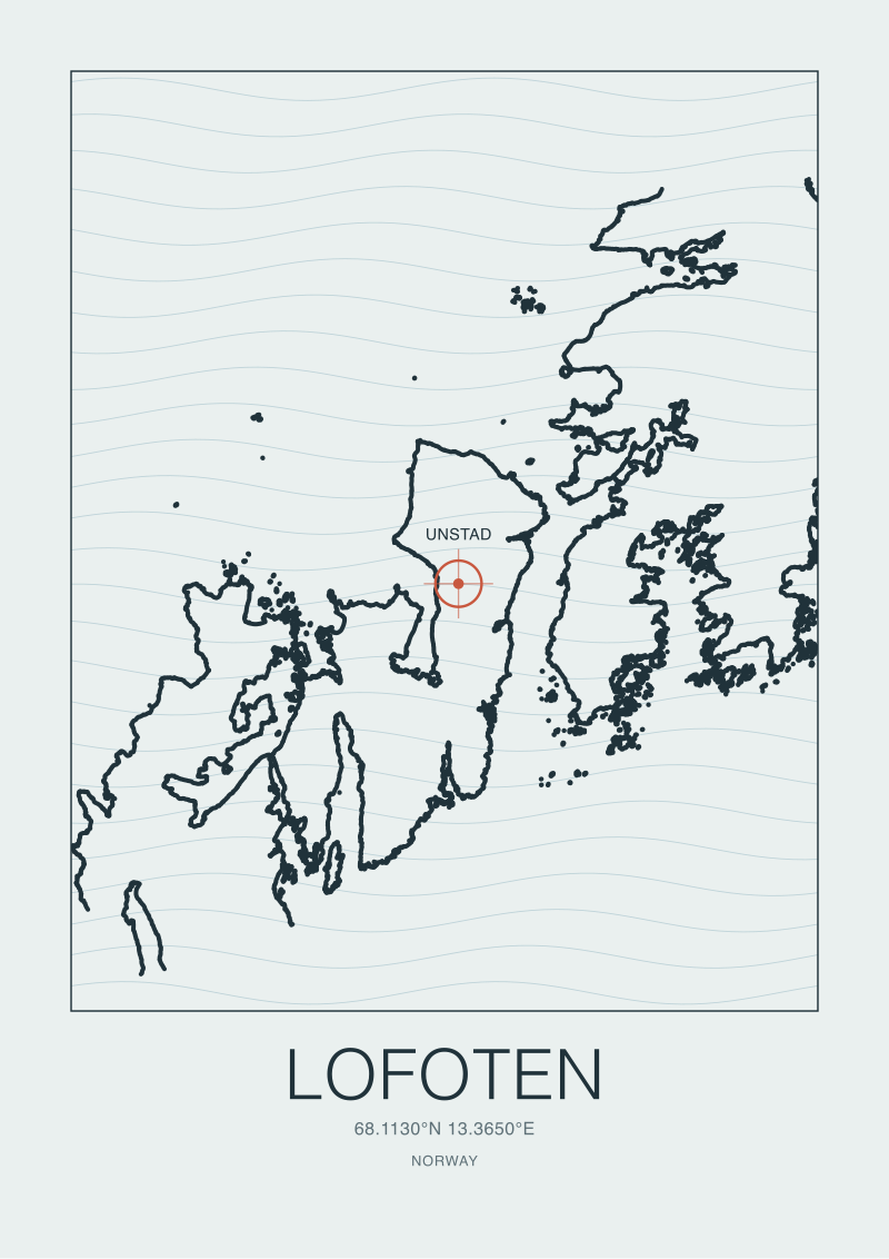 Lofoten
The print from this article · from €29.95
View the print →
Lofoten
The print from this article · from €29.95
View the print →
Finding #4: Why the Print-Shop Advice on This Comparison Is Usually Wrong
We have read the standard framings. "Hossegor for the party, Lofoten for the solitude." "Choose Hossegor if you like warm water." "Lofoten is for the adventurous surfer." These sentences describe a holiday. None of them describe a print. A print hangs on a wall for years and gets looked at by people who will never surf either place — the question it has to answer is compositional, not experiential.
The failure mode of the print-shop guides is that they inherit their vocabulary from surf-trip content and never audit whether that vocabulary transfers to a physical object on a wall. "Warm and lively" is not a visual property; a Hossegor coast drawn honestly is minimalist to the point of severity, a single horizontal line against horizon and sky. "Cold and dramatic" is a mood word; a Lofoten coast drawn honestly is baroque, dense with island edges. The correct axis is not warm-versus-cold. It is minimal-versus-maximal, linear-versus-fractal, one-line-versus-many. Once you name it that way, the choice stops being about which trip you would rather take and becomes about which shape belongs in the room the print will live in. That is the useful comparison, and it is the one nobody sells you.
| Attribute | Hossegor | Lofoten |
|---|---|---|
| Coastline geometry | Near-linear, sedimentary | Fractal, glacially carved archipelago |
| OSM coastline segments (frame) | Few, continuous | Many hundreds across island group |
| Named subject on map | Commune, section of Landes coast | Six-island chain across ~160 km |
| Composition class | Horizon + beach + one river mouth | Silhouette of teeth, sea between |
| Best print scale | Regional (Capbreton–Seignosse) | Archipelago-wide, with points labelled |
What This Does NOT Prove
A landform comparison is not an aesthetic verdict. We are not saying a Lofoten print is objectively better than a Hossegor print, or vice versa — a minimalist horizontal composition is exactly right for some walls and exactly wrong for others, and the same is true of a dense archipelago silhouette. What we are saying is that most existing guides answer the wrong question, and once you correct the question, the choice becomes obvious rather than agonising.
Nor does this piece address the surf itself. We have deliberately not compared wave quality, seasonality, or the experience of being in the water at either place, because those are forecast and trip variables and this is a cartography desk. We have also not opined on the price of any print, ours or anyone else's, or on framing choices, or on whether either coast is best represented in ink, screen-print, or digital render — each of those is a separate argument, and each deserves its own honest treatment rather than being smuggled into a comparison that is fundamentally about shape.
The Takeaway
Buy the Hossegor print if you want a horizon; buy the Lofoten print if you want a silhouette. That is the whole choice, once the coastline data is allowed to speak.
FAQ
Is Hossegor actually one specific surf break, or a stretch of coast?
Hossegor is a commune in the French Landes whose famous break, La Gravière, sits offshore near 43.6713°N, -1.442°E. On the ground and on any honest map, the coast at Hossegor is continuous with dozens of kilometres of near-identical beach running north toward Seignosse and south to the Capbreton jetties. A print titled "Hossegor" should therefore include the surrounding Landes system to be visually distinct — a tight frame on the commune alone renders as anonymous sand.
Does a "Lofoten" print depict Unstad specifically?
It should not, if the label is being used honestly. Lofoten is a Norwegian archipelago of six main islands stretching roughly 160 kilometres, and its recognisable silhouette on any map is the whole island chain, not a single bay. Unstad is one pocket of sand on Vestvågøya near 68.268°N, 13.581°E; a print of Unstad is a legitimate object, but it is an Unstad print, not a Lofoten one. Conflating the two flattens the archipelago into a beach.
What data did you use to compare the two coastlines?
We queried OpenStreetMap's `natural=coastline` way data via the Overpass API for both regions, clipped to frames wide enough to hold the surrounding shore that a print would actually depict. OSM's coastline layer is maintained by local contributors and licensed under ODbL, which makes it the standard reference for cartographers who need current, editable geometry rather than a satellite-traced approximation. We did not use swell, wind, or temperature data — those are forecast variables, and this comparison is about landform.
Why do you push back on the "warm vs cold" framing so many guides use?
Because "warm" and "cold" describe trip experience, not visual composition, and a print is a visual object that lives on a wall for years. The honest axis between these two coasts is linear versus fractal — Hossegor is a near-straight sedimentary shoreline that renders as minimalist horizon; Lofoten is a glacially fractured archipelago that renders as dense silhouette. Choosing between them on temperature is choosing a holiday. Choosing between them on shape is choosing a print.
If I only have wall space for one, how do you actually decide?
Look at the room, not the trip. If the wall wants calm — long horizontal lines, negative space, a composition that recedes — Hossegor drawn wide from Capbreton to Seignosse is the honest answer. If the wall wants complexity — a silhouette that repays close reading, edges that keep giving detail as you approach — Lofoten as the full archipelago is the honest answer. Both prints, drawn from real coastline data, live at our shop; neither is universally correct.
Are there surf coasts in Europe that split the difference between these two?
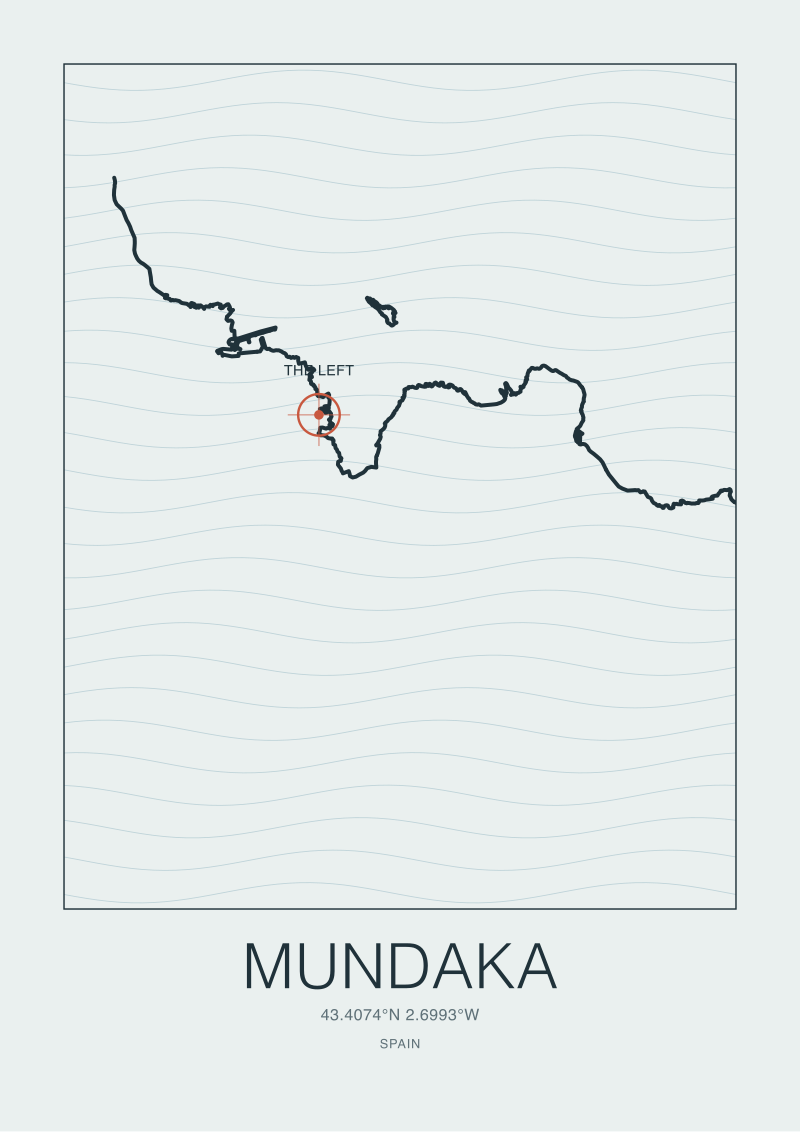
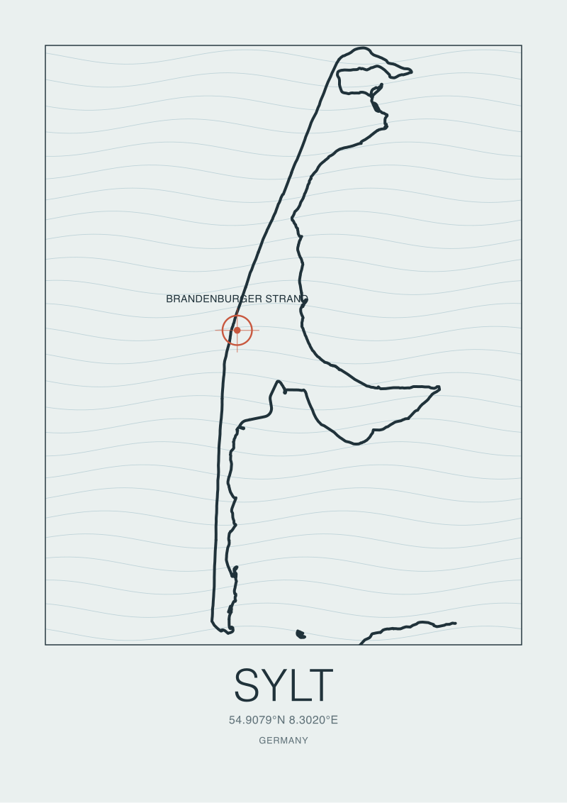
Yes, several. The Basque coast around Mundaka and Bakio has the sedimentary-plus-headland mix that sits between pure Landes linearity and full Lofoten fracture. Ericeira in Portugal offers a reserve-designated coast with real geological variation across a compact frame. Sylt in the German North Sea is a single long barrier island that reads compositionally closer to Hossegor than most people expect. Each of those is its own print, and each answers a different compositional question than the two coasts compared here.
What does the OSM coastline data not tell you?
It tells you where land ends and sea begins at mean high water, according to whoever last edited that section. It does not tell you seafloor bathymetry, which is why waves break where they break; it does not tell you sediment type, dune height, or vegetation; it does not tell you tidal range or the seasonal migration of sandbars. For a print that depicts a coast as a shape, the coastline layer is the correct primary source. For a piece that explains why a wave forms, you need bathymetric charts on top — a separate dataset and a separate argument.

New breaks and 10% off your first print.
One email now with your code. No noise after.