43.4074°N, 2.6993°W.
That is the coordinate of one sandbar. There are thousands of surfable coordinates in Europe. Only one draws the shape of wave that lives at this pair of decimals, and it draws it only when a river, a tide, and a swell all agree on the same afternoon. This is an investigation into what makes that agreement possible — and why the wave misses more seasons than it makes.
Methodology
We started with coastline geometry. The line drawn along the shore at Mundaka comes from OpenStreetMap's `natural=coastline` layer, pulled via Overpass under the ODbL licence — the same dataset we use for our own coast prints. We then overlaid the boundary of the Urdaibai Biosphere Reserve, designated by UNESCO in 1984, and the recorded course of the Oka river as it enters the Bay of Biscay from the south.
For wave mechanics we relied on standard oceanography: swell refraction over shallowing bathymetry, sediment transport by tidal currents, and the geometry of ebb-tide sandbars at river mouths. We used no personal wave-height claims and made no predictions. Where the record is folklore rather than physics — "best day ever" stories, invented tow-in metrics — we left it out. The question is not how big Mundaka gets. The question is why it exists at all.
Finding #1: The Wave Is Drawn By the River, Not the Ocean
The default mental model for a surfable wave places the ocean in charge. Swell arrives from deep water, meets the coast, and breaks against whatever the shore happens to look like. That model is wrong at Mundaka.
The Oka river carries sand and silt out of the Basque interior, past the villages of Gernika and Murueta, and delivers it in suspension to the Bay of Biscay. At the mouth, the current slows as it meets the sea, and the load drops out of the water. Twice a day, the flood tide pushes some of that sediment back inland; twice a day, the ebb pushes it seaward. The net vector, over years, is a sandbar that stands off the west bank of the estuary — long, narrow, and oriented along the axis the ebb tide prefers.
That sandbar is the wave. The Atlantic supplies energy. The estuary supplies shape. Without the Oka, there would still be swell at 43.4074°N, 2.6993°W — but it would break on a nothing beach and go nowhere in particular. The sandbar is what turns raw energy into a left-hander that peels along a predictable line, and the river is what draws the sandbar.
This is the reversal that matters. Beach breaks are usually described as ocean-authored. Mundaka is river-authored, and the ocean is the ink.
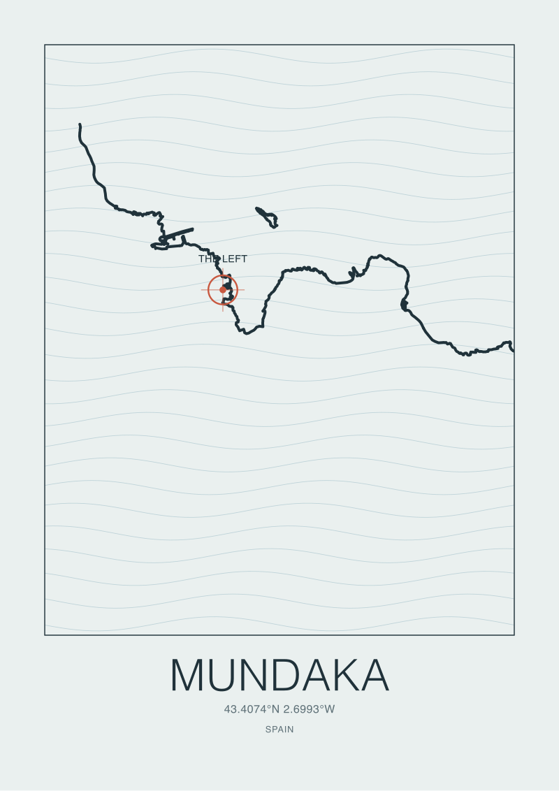 Mundaka
The print from this article · from €29.95
View the print →
Mundaka
The print from this article · from €29.95
View the print →
Finding #2: The Swell Window Is Narrower Than the Coast Looks
Look at a map of the Cantabrian coast and it appears to face wide open — the Bay of Biscay funnels North Atlantic swell straight into the north face of Iberia. In practice, the swell window that reaches Mundaka's sandbar is a narrow slice of that wide arc.
The village sits on the west bank of the estuary, tucked slightly behind the Cape Ogoño headland to the east and further protected by the geometry of the ría itself. Swell arriving from due west spends its energy on the cliffs west of Bermeo before it ever reaches the sandbar. Swell from the north-north-east passes across the mouth at the wrong angle to refract onto the bar. The window that works is narrow: broadly north-west to north-north-west, refracted as it feels the shallowing bathymetry of the estuary approach, and turned progressively left as it climbs the outer edge of the sandbar.
Refraction is the mechanism. Waves in shallowing water slow along the parts of the wavefront that touch bottom first, and the wavefront pivots toward the shallow zone. At Mundaka, the sandbar is the shallow zone, and the refracted wave arcs along its length rather than closing out across it. The angle at which the wave hits the bar determines whether it peels cleanly or shuts down. Miss the window by a quarter of a compass point and you have swell without a wave — energy on the coast, but no line to draw.
Finding #3: The Tide Chooses When the Wave Exists
The Bay of Biscay is macrotidal. Spring range at the Basque coast commonly runs above four metres, and the volume of water moving in and out of the Urdaibai estuary at each tide is large enough to reorganise the current field across the sandbar every six hours.
That current field is what selects the working window. On the flood, water pushes into the estuary against the wave, damping the peel and softening the outer edge of the bar. On the slack around high water, the wave has water over it but no current to hold its face. On the ebb, water rushes out of the estuary along the west bank, running against arriving swell and steepening the wave face as it climbs the bar. There is, in every tidal cycle, a phase — typically part-way down the ebb — where depth, current, and swell angle converge on the geometry the sandbar is drawn for.
This is why Mundaka is described as a mid-tide wave rather than a high-tide or low-tide wave. It is not because the sandbar prefers a particular depth in isolation. It is because the ebbing river is part of the wave. Take the estuary out of the equation and you have a shoal off a village. Put the estuary back in and, for a window of maybe two hours per tide, the sandbar becomes an instrument.
Finding #4: The Reserve Protects the Cartography, Not the Vibe
In 1984, UNESCO designated the Urdaibai estuary a Biosphere Reserve, covering roughly 220 square kilometres of the Oka basin and its coastal edge. The designation is often described in tourist copy as a protection of "atmosphere" or "authenticity". It is neither. It is a protection of the sediment budget.
A river-mouth sandbar exists in dynamic equilibrium. Sediment arrives, sediment leaves, and the bar holds its shape because the arrivals and departures balance over years. Break the balance — dredge the channel to widen the port, harden the banks, gravel-mine the upper Oka — and the bar migrates, degrades, or disappears. Nazaré's canyon is a fixed piece of bathymetry. Mundaka's sandbar is a living deposit that requires the river to keep drawing it.
The Reserve's rules make that drawing possible. Restrictions on dredging inside the estuary, buffered land use along the Oka, and limits on hard-bank construction all mean the sediment budget stays close to what it has been for as long as the wave has been known. When the sandbar has been observed to weaken briefly — as it did in the mid-2000s after works upstream — its return has been treated as a matter of hydrology rather than luck.
This is the geographic reading of the wave. It is not protected by law because it is famous. It is famous because it is protected by law. Move the estuary and Mundaka becomes another west-facing Basque village. Leave the estuary alone and it stays a coordinate that draws a shape.
 Nazaré
The print from this article · from €29.95
View the print →
Nazaré
The print from this article · from €29.95
View the print →
The Alignment Table
For the wave to exist on any given afternoon, four independent systems have to agree. Any one out of alignment removes the wave from the day.
| System | Requirement | Failure mode | Time-scale |
|---|---|---|---|
| Sandbar | Present, oriented along the ebb-current axis | Migrates or degrades if the sediment budget breaks | Years |
| Swell | Arrives NW to NNW, long-period ground swell | Windswell or wrong-angle refracts off the bar | Days |
| Tide | Mid-ebb, depth over bar, ebb current running | Flood, slack, or full high tide flattens the peel | Hours |
| Wind | Offshore or light, from the south-east quadrant | Onshore NW closes out the face | Hours |
The rows are in descending time-scale on purpose. The sandbar takes years to build and years to lose. Swell fields evolve over days. Tide windows open and close in hours. Wind can spoil a working window in minutes. The wave sits on top of a stack of clocks, and the slowest clock is the one the Biosphere Reserve is protecting.
What This Does NOT Prove
This is a geographic reading, not a forecast. Nothing here tells you when Mundaka will work next, and nothing here quantifies the wave's size on any specific day. We have not audited claimed wave-height records, and we have not adjudicated the folklore around the biggest sessions on the bar. Those are separate arguments, and they belong to people with tide-marked calendars and lifeboat crews.
We have also not treated the wave as a cultural object. The village's role in Basque coastal identity, the etiquette in the lineup, and the tension between local surfers and visiting crowds all matter to how Mundaka is lived. But they are downstream of the geography, and the geography is what we came to draw. If our shop happens to carry a coastline print of Urdaibai at /shop/, it is because the estuary is worth drawing on its own terms — not because we think a print settles any argument about the sandbar's future.
The Takeaway
Mundaka's left is a river-mouth wave. Remove the Oka and the estuary and you remove the wave. Everything else — swell, tide, wind — chooses when the wave shows up; only the river chooses that it exists at all.
FAQ
Where exactly is Mundaka on a map of the Basque coast?
Mundaka sits on the west bank of the Oka river's estuary in Bizkaia, Spain, at 43.4074°N, 2.6993°W. That coordinate places the village a short distance north-east of Bilbao and inside the Urdaibai Biosphere Reserve, which covers the lower Oka basin and its coastal edge. The wave breaks off the sandbar on the estuary's western shoulder, not on Mundaka's beach itself — a geographic distinction that matters, because the sandbar is river-authored, not beach-authored.
Why is Mundaka called a left-hand wave rather than a right?
"Left" and "right" describe the direction the wave peels from the surfer's point of view as they ride it toward shore. At Mundaka, arriving swell refracts across the outer edge of the ebb-tide sandbar and breaks progressively toward the estuary mouth, so a surfer standing on the wave looks to their left as it peels. The direction is not a stylistic choice — it is dictated by the sandbar's orientation, which is in turn dictated by the axis the ebb current prefers.
Does the Mundaka sandbar ever disappear?
Yes. A river-mouth sandbar exists in dynamic equilibrium between sediment arrivals from upstream and departures out to sea. When the balance breaks — for example, after works in the upper estuary in the mid-2000s — the bar can migrate, thin, or fail to hold its ridable geometry. The wave has returned each time the sediment budget has been allowed to settle. That is the practical reason the Urdaibai Reserve's dredging and land-use rules matter to surfers, even where the rules were written for ecology.
Is Mundaka the same kind of wave as Nazaré?
No. Nazaré's wave is engineered by a fixed piece of bathymetry — a submarine canyon that focuses North Atlantic swell onto a specific stretch of Portuguese coast. That geography is stable on human time-scales. Mundaka's wave is engineered by a living sediment deposit that the Oka river continues to draw. Nazaré is a canyon wave; Mundaka is an estuary wave. Both are geographic, but the geography behind Nazaré is carved into rock and the geography behind Mundaka is redrawn every tide.
How does the Urdaibai Biosphere Reserve designation affect the wave?
The Reserve, designated by UNESCO in 1984 across roughly 220 square kilometres of the Oka basin, restricts the kinds of activity that would break the estuary's sediment budget — heavy dredging, unregulated bank hardening, upstream gravel extraction. Those restrictions were written for the estuary's ecology, but they double as protection for the sandbar. Without the Reserve, the pressures that reshape most working ports and estuaries in Europe would apply here as well, and the wave would sit on a much less protected geography.
Why is Mundaka considered a mid-tide wave?
Because the ebbing river is part of the wave. On a flood tide, current pushes into the estuary against arriving swell and softens the wave face. At high slack, there is depth but no current to hold the peel together. On the ebb, water rushes seaward along the sandbar's western edge, running against the swell and steepening the face as it climbs the bar. The window where depth, current, and swell angle converge on the sandbar's drawn geometry sits partway down the ebb — a matter of hours, not the whole day.


New breaks and 10% off your first print.
One email now with your code. No noise after.