Eight charted soundings taken off Grande Plage at 43.4853°N, -1.5584°E describe eight different stories, depending on who is reading them. The seabed profile between the shoreline and the twenty-metre contour is not a single number. It is a sequence of transitions — shelf, slope, trough, inner bar — and each transition is a different piece of information for a different reader. There is no universal answer to what the eight depths mean. There are three useful readings, and the one that applies depends on what the reader is trying to see. This piece walks through all three.
We take the soundings as a notional sequence: a near-shore reading inside the surf zone, three readings across the inner bar system, two across the outer trough, one on the mid-shelf, and one at the twenty-metre contour. The numbers themselves are prosaic. The ordering is what matters. A hydrographer, a shaper, and a harbour pilot — three composite readers, drawn from the trades that actually use seabed data — would each extract a different signal from the same chart. We will walk through each.
Scenario 1: The Hydrographer Reading the Twenty-Metre Shelf
Imagine a hydrographer, hired to update a navigation chart of the Basque coast, pulling the eight Biarritz soundings into a worksheet. Picture an analyst who has never been in the water at Grande Plage and has no interest in waves. Their job is to produce a chartable surface — a smoothed bathymetric model that mariners can trust. For them, the eight depths are not eight points. They are eight constraints on an interpolated grid.
The reading starts at the twenty-metre contour. Biarritz sits at the southeastern end of the Bay of Biscay, where the continental shelf narrows considerably as it approaches the Cap Breton submarine canyon system to the north. For the hydrographer, the twenty-metre sounding is the one that anchors the outer edge of their inshore model. Its position relative to the shoreline tells them how steeply the shelf is dropping away in this specific transect. A shallower twenty-metre contour, measured by distance from the shoreline, means a wider inshore shelf and a smoother interpolation. A tighter contour means the slope is already asserting itself close to the beach.
The mid-shelf sounding — the one between the outer trough and the twenty-metre line — is their second anchor. It confirms whether the slope is monotonic or whether there is a terrace. Terraces matter because they generate interpolation error if the chart smooths through them. The hydrographer logs whether the slope between the two outer readings is linear, concave, or stepped. On the Biarritz transect, the geometry is unlikely to be linear: the Basque shelf is structurally more complex than, for instance, the Landes coast to the north.
The three bar-system readings and the near-shore sounding are, for the hydrographer, almost noise. They are useful as a confirmation that the model is dense enough near shore. But a navigation chart does not need to resolve sandbars. Sandbars migrate seasonally; by the time the chart is printed, the geometry will have shifted. The hydrographer treats the bars as a time-averaged mound and smooths through them. What survives in the published chart is the slope, the trough, and the shelf.
That is the first reading. Eight soundings become four numbers that matter and four that are deliberately absorbed into a smoothed surface.
Scenario 2: The Shaper Reading the Inner Sandbar Depths
Now picture a different reader. Let us say a surfboard shaper, working from a studio inland of Biarritz, who has been asked to design a board specifically for Grande Plage conditions. They have the same eight soundings. They care about different numbers entirely.
For the shaper, the twenty-metre contour is useful only as a boundary condition. It tells them that long-period Atlantic swell has already begun to interact with the seabed well before it reaches the beach. The question they are trying to answer is more local: by the time a wave reaches the surf zone, what has the seabed done to its shape?
Their eye goes to the three bar-system readings and the two outer-trough readings. Those five numbers describe the geometry that actually bends the wave. A beach break like Grande Plage breaks because waves refract across the inner bars; the depth differential between the trough and the crest of the inner bar is the geometric input that determines how steeply the wave face will stand up when it finally breaks.
The shaper is doing something a hydrographer would never do: they are reading the five numbers as a sequence that implies a wave shape. A deeper trough with a shallower inner bar means a sharper refraction, which means a wave face that will stand up more vertically for its given height. A gentler profile — less differential between trough and bar — produces a wave face that peels at a more oblique angle. One asks for a shorter, more responsive board; the other rewards a longer rail that can hold a line across a slower-breaking face.
They are not predicting any specific day. They are reading the time-averaged geometry of a beach that reorganises itself with the seasons and the storms. The near-shore sounding — the one taken inside the surf zone — is their final data point. It tells them where the wave finally dissipates its energy. The distance between the inner bar and the shoreline, read against the near-shore depth, implies the width of the whitewater zone a rider will have to cross on the paddle out.
Eight soundings. Five that matter structurally. Three that frame the structural five. The shaper's reading is almost the inverse of the hydrographer's: they absorb the shelf and resolve the bars.
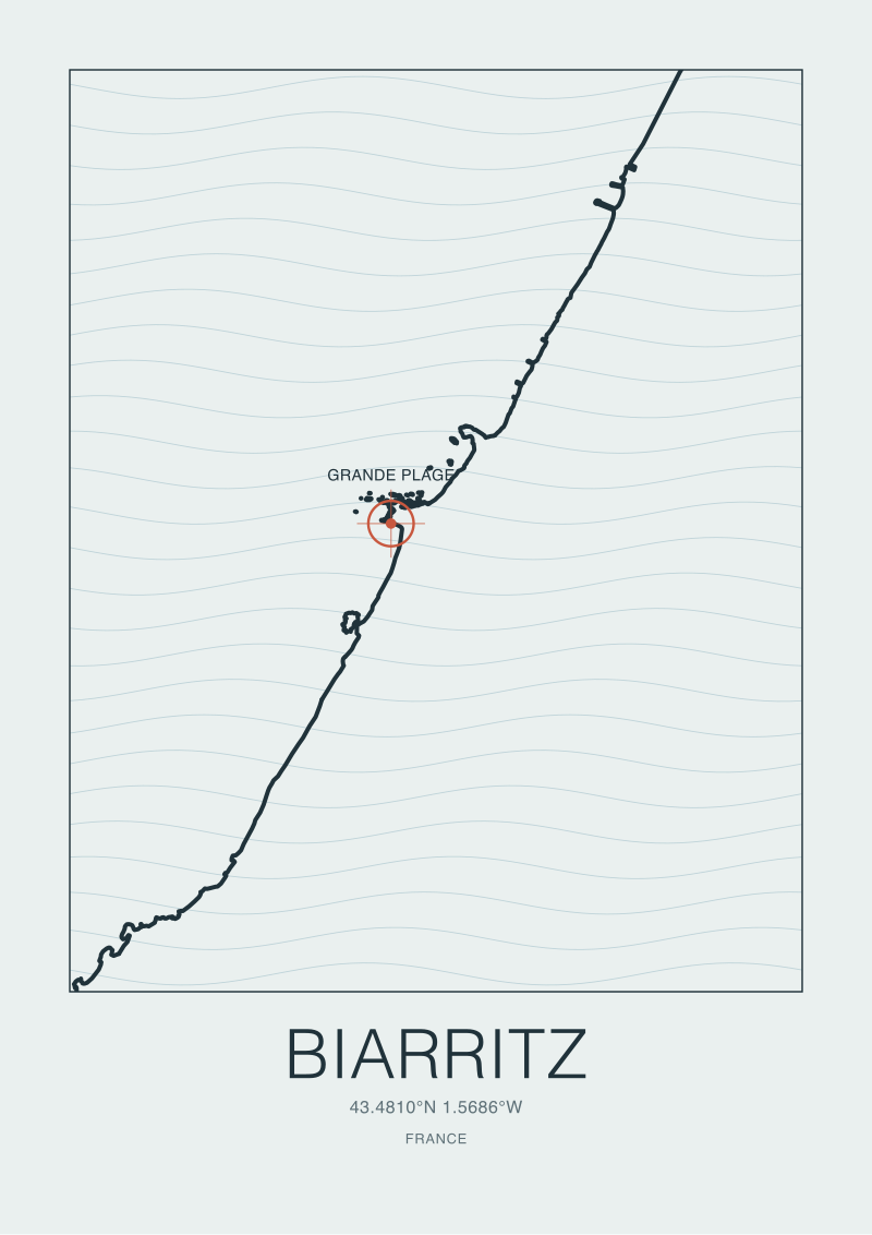 Biarritz
The print from this article · from €29.95
View the print →
Scenario 3: The Harbour Pilot Watching the Five-Metre Contour
The third reader is a harbour pilot. Imagine a pilot responsible for small-vessel approaches to the Biarritz coast — a working professional whose entire attention is on keel clearance and the predictability of a vessel's path through the shallows. For them, the eight soundings resolve into a single contour: the five-metre line.
The five-metre contour matters because it is the practical threshold between water a modest keel can transit confidently and water where the pilot has to start thinking about swell draw-down. A vessel with a two-metre draft in five metres of still water has three metres of clearance; in the trough of a long-period Atlantic swell, that clearance can be reduced significantly over the few seconds a wave trough passes beneath. The pilot's working rule is that the five-metre contour is where margin starts to matter.
For the pilot, the eight Biarritz soundings sort themselves into two bins: inside the five-metre line and outside it. The two outer-trough readings and the mid-shelf and twenty-metre soundings are irrelevant — they describe water that is deep enough to ignore for approach purposes. The near-shore sounding is also irrelevant, but in the opposite direction: it describes water the pilot would not enter under any circumstances.
What interests them are the readings that sit on either side of the five-metre line. Grande Plage is an open beach, not a harbour approach, but the Biarritz coast has small working ports — Port des Pêcheurs most prominently — and the five-metre contour runs continuously along this stretch of coast. The pilot cares whether the contour is smooth or whether it kinks around the inner bar system. A kinked five-metre line means the inner bars are shallow enough to intrude on it, which means a route that stays outside the bars will not necessarily stay in six metres of water.
The pilot's reading is the most conservative of the three. They absorb everything except one line on the chart. They are not interested in why waves break where they break, nor in the broader slope of the shelf. They want to know, with no ambiguity, where their minimum draft stops being safe.
What All Three Share
What all three readers share is the discipline of ignoring most of the data in front of them. A chart that resolves eight depths off a single beach is, from any one practitioner's point of view, an over-resolved document. The hydrographer absorbs the inner bars into a smoothed surface. The shaper absorbs the shelf into a boundary condition. The pilot absorbs everything except a single contour.
This is the pattern that unifies the three readings. Seabed data is not information in itself. It becomes information only when a specific question is pressed against it. The eight soundings off Grande Plage are, in that sense, a resource rather than an answer — a shared substrate that three different trades can interrogate for three different purposes without any of them being wrong.
The second thing they share is that all three readings are structural rather than temporal. None of them is a forecast. The hydrographer is building a chart that will be valid for years. The shaper is designing a board around the time-averaged shape of a beach, not around any particular swell. The pilot is marking a contour that defines a working envelope, not predicting the state of the sea at a given moment. The seabed is slow. The soundings describe the geometry a coast has settled into over many winter storms and summer calms, and that geometry is what each reader uses.
Which Scenario Is You
If you came to this piece looking for a wave forecast, none of the three readings is yours. We do not do forecasts, and the chart cannot give you one.
If you are trying to understand why Grande Plage breaks the way it does, your reading is closer to the shaper's. The geometry you want to look at is the bar system — the depth differential between trough and crest, read as a sequence from offshore to the beach. The soundings that matter to you are the five in the middle of the eight.
If you are navigating these waters, even as a small-boat sailor, your reading is the pilot's. The five-metre contour is the line you plan around. The other seven soundings are context, not operational data.
And if you are reading these waters as a cartographer — because you draw coasts, or because you are curious about how the Biscay shelf behaves at its southeastern corner — your reading is the hydrographer's. The shelf and the slope are the signal. The bars are weather at a different time scale, and they do not belong on your chart.
We draw these coasts for a living, which puts our own desk closest to the hydrographer's reading, with occasional glances at the shaper's. The Biarritz plate in our atlas sits at the shop for anyone who wants the Grande Plage transect as a wall-sized print.
FAQ
What is a sounding, and how is it different from a depth?
A sounding is a single measured depth at a specific charted location, typically referenced to a defined vertical datum such as lowest astronomical tide. "Depth" is the general concept; a sounding is a formal observation of it. Charts show soundings as discrete numbers; isobaths (contour lines) interpolate between them. The distinction matters because interpolation introduces error, and chart users have to know which numbers they are reading as data and which they are reading as a smoothed surface.
Does the seabed off Grande Plage change between seasons?
The deep structure — the shelf, the slope, the twenty-metre contour — is effectively stable on human timescales. The inner bar system is not. Beach breaks reorganise their sandbars across winters and summers, and the depths across the inner bars at Grande Plage can shift measurably between a calm August and a stormy February. Published hydrographic charts smooth through this seasonal variation; shapers and other near-shore readers do not.
Why does Biarritz sit near a submarine canyon?
The Cap Breton canyon system incises the continental shelf north of Biarritz and brings deep water comparatively close to the Basque coast. The canyon is a documented feature of the Bay of Biscay seabed. Its structural effect is that the continental slope asserts itself closer to shore here than it does along the straighter Landes coast further north — a reason the inshore bathymetry at Biarritz behaves differently from the long sand-shelf coasts above it.
How is a hydrographic chart updated?
Modern charts are updated through a combination of multibeam echo-sounder surveys, satellite-derived bathymetry in shallow clear water, and corrections contributed by vessels and port authorities. National hydrographic offices — SHOM in France, in the case of Biarritz — maintain the official product. Updates for inshore zones are more frequent where traffic density justifies them; purely natural coastlines with no commercial port approach may go years between formal re-surveys of the inner shelf.
Can a sailor use a published chart to read surf zones?
No, and no competent sailor would try. A chart's purpose is navigation, which means its model smooths through exactly the small-scale seabed features that determine where and how waves break. The chart will tell a sailor whether the water under their keel is deep enough; it will not tell them whether a sandbar two hundred metres inshore is going to turn an approaching swell into a plunging break. Those are different documents for different trades.
What vertical datum do the Biarritz soundings use?
French hydrographic charts reference soundings to the lowest astronomical tide, consistent with international hydrographic standards. Readers converting a sounding to an actual depth at a given moment have to add the tidal height above that datum, which varies through the lunar cycle and the semidiurnal tide. The eight soundings discussed here are read as datum-referenced depths — the deepest water the chart commits to showing at that point.
New breaks and 10% off your first print.
One email now with your code. No noise after.